When there is no house, a Claremont land appraisal turns on what the parcel can legally and physically become. The deciding facts are the city's zoning and hillside rules, legal access, slope and buildable area, and whether sewer and water reach the lot. The appraiser states the highest and best use, then compares land sales of the same kind, starting in Claremont, and explains every adjustment. The report is an independent opinion of market value as of a stated date; it does not predict a figure, and the trustee, lender or court that reads it decides how it is used.
Start with highest and best use
Highest and best use is the reasonably probable use of the land that is legally permitted, physically possible, financially feasible and the most productive of those. On vacant land in Claremont it is the first finding in the report. A flat lot north of Foothill Boulevard with sewer at the street and a foothill parcel above Claraboya are both "land", but they do not sell to the same buyer or on the same evidence.
The legal test comes from the city. Claremont's Zoning Code and Maps page says all new construction is regulated by the Zoning Code, which outlines the type of uses permitted on each parcel, and the page publishes the zoning map dated July 9, 2024, the Rural Claremont Architectural and Landscape Standards and Titles 16 and 17 of the Municipal Code, zoning and subdivision. The appraiser reads the parcel's designation from those documents, not from the assessor's records or a listing.
Claremont's hillside rules change what a parcel can carry
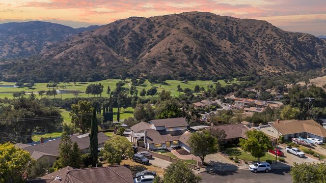
Above the postwar tracts, the foothills hold Claraboya and Padua Hills, near the Padua Hills Theatre, and Northeast Claremont, where the Stone Canyon Preserve homes sit beside the Wilderness Park. Hillside land there is governed by more than acreage. Claremont's General Plan glossary describes the Hillside Ordinance's cluster sites as areas that allow the transfer of some or all of the development credits from another hillside parcel, and it defines a transfer of development credit as a potential entitlement to construct one dwelling in a designated hillside cluster area, exercised only when transferred to a receiver parcel under the city's Land Use and Development Code.
For an appraiser, that means two adjacent foothill parcels toward Padua Hills can support very different projects. One may be a buildable homesite with a road and a pad. Another may carry its development potential as a credit tied to a different site, or face slope that leaves little room for a house. Whether a given parcel has a credit, a cluster designation or a buildable pad is the city's determination, and the report cites the documents it relied on.
Legal access and easements
Legal access is a recorded right to reach the parcel from a public road, either by frontage on the road or by an easement across another owner's land. The city's glossary defines an easement as a recorded right or interest in land that belongs to someone else, entitling the holder to some use of it. A foothill lot reached by a shared driveway may have physical access and no legal access at all; if access cannot be confirmed from the title report, the report says how it was treated.
Slope, utilities and the cost of getting to a house
The glossary expresses slope as a ratio of horizontal distance to vertical distance. On a hillside lot, slope decides where a pad, a driveway and any septic field can go, and how much grading and retaining the next owner faces. Utilities matter as much. The same glossary contrasts a sanitary sewer, which carries waste to a treatment plant, with septic tanks or leach fields that hold it on site. A parcel with sewer and water at the frontage competes in a different market from one that needs a septic system or a long water line, and the comparable sales have to reflect that difference rather than ignore it.
When buildability is uncertain
Many land assignments reach the appraiser before every question is settled. The report handles that openly. An extraordinary assumption is an assumption about uncertain facts that, if false, could change the result; for example, that a recorded easement provides legal access, or that the parcel can be served by sewer. A hypothetical condition is a condition assumed for the analysis that is known to be contrary to fact, such as valuing the land as if a pending lot line adjustment were already approved. Either one is stated plainly, and the report never assumes a lot is buildable without saying so.
Comparable land sales, and why the search widens
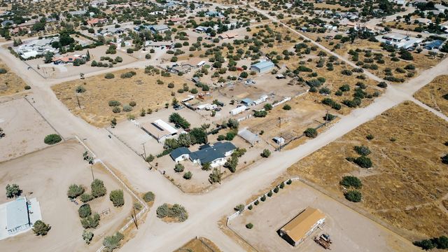
Claremont has few vacant land sales in any given period, and fewer still in the foothills. The search starts in Claremont, with sales matched for access, slope, utilities and zoning. When it widens, toward the La Verne foothills, Upland's north end or the land toward Mt. Baldy, the report says how far it went and why. Claremont is assessed by the Los Angeles County Office of the Assessor, and Upland and Montclair, across the line, by the San Bernardino County Assessor-Recorder-County Clerk; a sale from across the county line is used only when it is genuinely better evidence, with the location adjustment explained.
The land portion of a property tax bill is a county assessment, not an appraisal, and a portal's automated estimate is not an appraisal either; neither can read a title report, a slope or a hillside credit.
Who orders a Claremont land appraisal, and where the scope ends
These are the kinds of assignments that come in: a trustee distributing a foothill parcel, heirs who need a value as of a date of death, an owner deciding whether to build or sell, and an attorney in a dispute over land. The report states its intended use, what the report will be used for, and its intended users, the people entitled to rely on it. Its effective date, the date the opinion of value applies to, may be current or, for an estate, in the past.
There is also a license limit. The Appraisal Foundation describes the Certified Residential scope as one-to-four residential units without regard to value or complexity, and a Certified General appraiser as able to appraise all types of real property; BREA sets the Certified Residential scope by reference to federal rule and the Appraiser Qualifications Board Criteria. A homesite whose highest and best use is a house fits a residential assignment. Land whose highest and best use is a multi-lot subdivision or a commercial project belongs with a Certified General appraiser, a point to settle before any engagement.
What to send
- The parcel number, a survey or plot plan, and a preliminary title report with recorded easements.
- Any city letters about zoning, hillside status or development credits.
- Sewer, water and power availability letters, or septic records.
Fees are set by the scope of the assignment and quoted before work begins, and they do not depend on the value. Reports are typically delivered three to five business days from the inspection.
Related reading and next step
The guide to appraising land and horse property covers access, slope and lot use across the coverage area, and the house-with-acreage guide explains site value and excess land once a home is on the parcel. For homes already built in the foothills, see Padua Hills property appraisal; for barns and arenas, the Chino horse property guide. The Claremont area page describes the city's pockets, and the land, acreage and equestrian knowledge center collects the rest. To scope a parcel, use vacant and hillside land appraisal or call (909) 324-6122.
Sources
- City of Claremont, Zoning Code and Maps, accessed November 6, 2026
- City of Claremont, General Plan and Land Use Map, accessed November 6, 2026
- City of Claremont General Plan, Appendix B Glossary, accessed November 6, 2026
- The Appraisal Foundation, Real Property Appraisal (classifications and scope), accessed November 6, 2026
- Bureau of Real Estate Appraisers, Real Estate Appraiser License Levels, accessed November 6, 2026
- The Appraisal Foundation, USPAP, accessed November 6, 2026
Gordon Hall, California Certified Residential Real Estate Appraiser, BREA No. AR003877 (lookup: https://www2.brea.ca.gov/breasearch/faces/party/view.xhtml?id=23601). Reports are prepared in conformity with the Uniform Standards of Professional Appraisal Practice (USPAP). Nothing here is legal or tax advice; admissibility is always the court's decision.
Frequently asked questions
How is land in Claremont appraised when there is no house?
The appraiser first states the highest and best use, the reasonably probable use that is legally permitted, physically possible, financially feasible and most productive. Claremont land sales with similar zoning, access, slope and utilities are then compared, and each adjustment and any wider search is explained in the report.
Does Claremont have special rules for hillside land?
Yes. The city's General Plan glossary describes Hillside Ordinance cluster sites and transfers of development credits between hillside parcels under the Land Use and Development Code. Whether a particular parcel is buildable or carries a credit is the city's determination, and the report cites the documents relied on.
What if it is not certain the lot can be built on?
The report says so. An extraordinary assumption, an assumption about uncertain facts that could change the result if false, is stated plainly, for example that an easement gives legal access or that sewer can reach the lot. The opinion of value is then read together with that assumption.
Is the land value on my Claremont tax bill an appraisal?
No. It is part of a county assessment by the Los Angeles County Office of the Assessor, not an appraisal. A land appraisal is an independent opinion of market value as of a stated date, built from closed land sales and the parcel facts.